The yellowcolor is assigned to trail n.3. The path is ring and is marked with directional green and light blue arrows. The path starts from the main car park of Colle di Buggiano, where you can park for free.
From the car park you go up the ancient paved road leading to the medieval village and in a few minutes you reach the main square outside the walls, where you can admire the Romanesque Church of S.Lorenzo. From the square through the door you walk through the small village, let yourself be inspired by the small streets that you will encounter will take you all to the exit.
When you reach the north gate, you leave the village behind and following the arrows you arrive at the provincial road to the locality Margine dei Ferri. Going to the left and then immediately to the right continue to Le Poiane, proceed walking next to the river Cessana between oaks and chestnut trees until you reach the ruin of an ancient nineteenth-century powder keg “La polveriera”.
The country’s elders say that during World War II all gunpowder was hidden under this bridge.
Here you will find the first fork, follow the path n Strada 3 going up to the right at Cucco and Vinzacchia.
Continue on the panoramic path 3 towards Cozzile
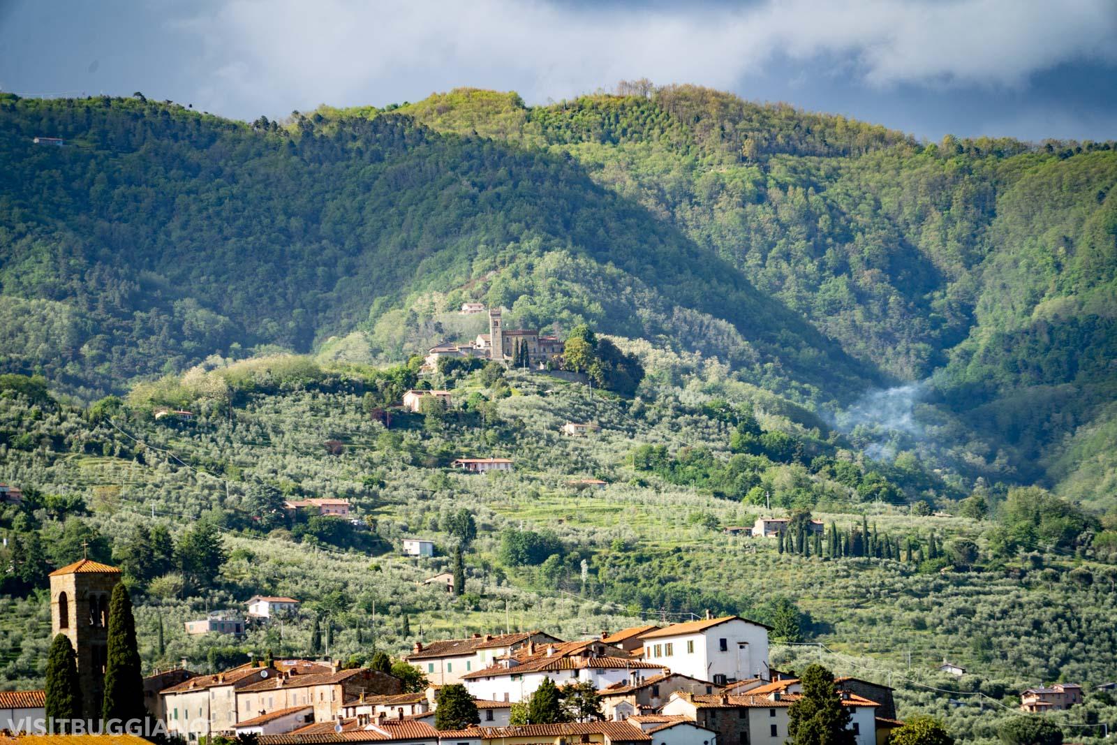
After one km we find another junction, take the road on the right that takes us towards the provincial road 31. Turn left and continue along the road to Cozzile. Keep to the right and follow the path of the old road, after a few meters on the left you will find a mule track that takes you to the castle. In front of the access door to the village you can admire a splendid panorama of the whole Valdinievole up to the sea. In the days without haze, it is possible to see even all the provinces and islands in front of Tuscany.
You can admire theDe Gubernatis Palace, suspended on the ridge. In the heart of the village there is a small square and some alleys offer extremely picturesque views.
Once crossed the small and charming village continue straight to the Margin and taking right we go on a cemented road with indications Poderino Lero and you get to the village of Massa, following an old path that passes through fields and woods.
Massa is among the oldest fortified towns in the area, with some ruins of the walls and its towers. You enter the village from the Porta dei Campi, and walking you get to the Romanesque Church of Santa Maria Assunta, inside the building there is a wooden Crucifix of the fifteenth century, and a glazed terracotta representing the Virgin and Child, which comes from Buglioni’s workshop. It is also possible to visit (according to opening days and hours) the Museum of San Michele, which displays paintings, liturgical vestments and sacred furnishings.
Leaving the village, at the gardens you go right on the provincial road 800 meters you take the fork to the right. After 300 meters to the left for locality Vetrignano, and continuing you reach again the locality Margin of Ferri and from here the provincial one that will bring back to the parking of Colle di Buggiano, to finish the walk.